Home Feed
Home
Search
Search
Add Review, Blurb, Quote
Add
Activity
Activity
Profile
Profile
Maps of the Disney Parks
Maps of the Disney Parks: Charting 60 Years from California to Shanghai | Kevin Neary, Susan Neary, Vanessa Hunt
1 post | 2 to read
It all started with a map. . . . Maps of the Disney Parks are more than just atlases used by guests to find their way to Big Thunder Mountain Railroad. They are snapshots of a place and time, relics treasured by collectors, and gorgeous pieces of artwork. In fact, it was a map-imagined by Walt Disney and drawn by Herbert Ryman-that was used to sell the idea of Disneyland to investors. Unfold this book bursting with beautiful maps from when the very first Disney Park opened in 1955 right up to today. Discover details on how and why the domestic and international parks have changed over time, and enjoy six decades worth of skillful creativity.
Amazon Indiebound Barnes and Noble WorldCat Goodreads LibraryThing
blurb
hgrimes
post image

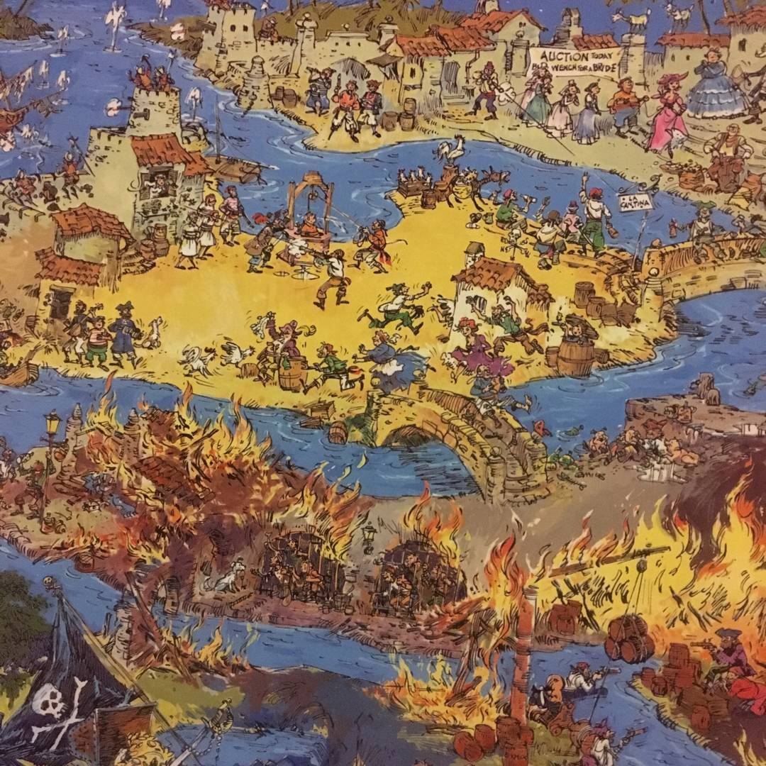
My husband got this amazing coffee table book that is a collection of maps from different years of all the Disney parks around the world. This one I cannot stop staring at! It‘s like Pirates of the Caribbean Where‘s Waldo. (Disneyland version) Can I get a giant poster of this and hang it on the wall??